Storm No 3 to cause rough weather in northern provinces
According to the National Center for Hydro-Meteorological Forecasting, at 4am this morning, the center of storm No. 3 was about 290 km east of China's Leizhou Peninsula, with maximum wind speeds of 117 kph.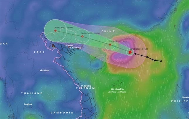
It is forecasted that by 4pm today (Thursday), the storm will move west-northwest at a speed of 25 kph. The storm's centre is about 21.7 degrees north latitude, 110.0 degrees east longitude, and about 230km east of Móng Cái District, Quảng Ninh Province.
The strongest wind in the area near the storm's centre is strong at levels 9-10 (75-102km/h).
Dangerous weather is expected in the East Sea until 4am tomorrow. All vessels operating in the hazardous zone are at high risk of being affected by strong winds, high waves and tornadoes.
Rough sea and heavy wind are also forecast in the northern area of the Gulf of Tonkin (including Bạch Long Vỹ and Cô Tô island districts) from noon today.
On land, from Thursday afternoon until Friday morning, the coastal area of Quảng Ninh Province is likely to have strong winds of level 6 and level 8.
Other northern localities should expect heavy rains from Thursday afternoon to late Friday night, with rainfall at 100-200 mm in most areas and more than 250 mm in some places.
The centre said that the north-central province of Thanh Hóa will also receive rainfall between 50-150 mm.