Tropical depression appears in East Vietnam Sea
A low-pressure area in the East Vietnam Sea strengthened into a tropical depression early on Wednesday morning and is forecast to become a storm in the next two to three days.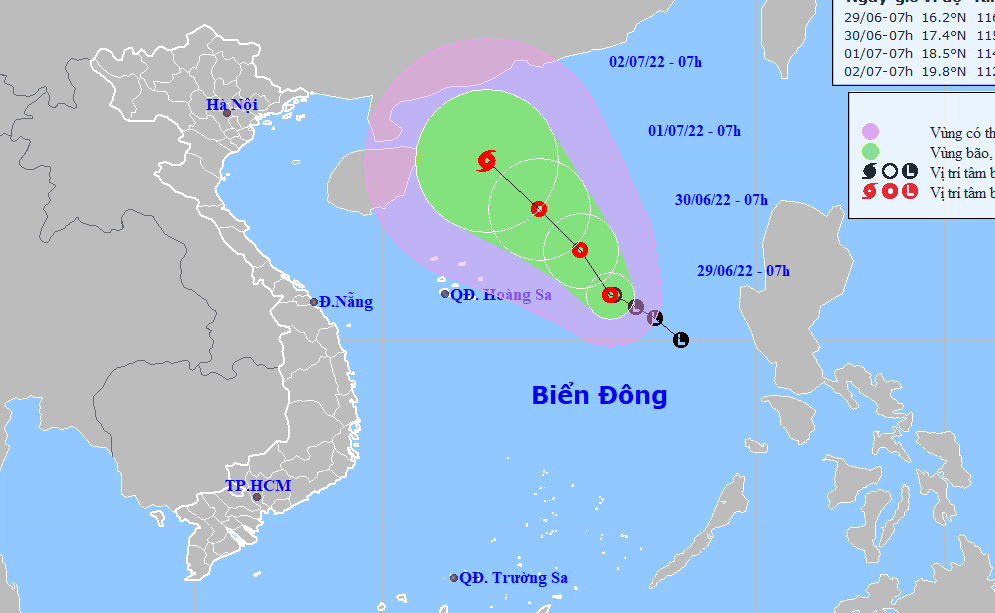
As of 7:00 am on Wednesday, the tropical depression was located 500 kilometers east of Vietnam's Hoang Sa (Paracel) archipelago, according to the National Center for Hydro-meteorological Forecasting.
The average wind speed was recorded at 40-50km per hour, while gusts reached up to 75km an hour.
The tropical depression is expected to travel northwest in the next 48 hours and pick up strength.
By 7:00 am on Friday, it will have been located around 350 kilometers northeast of Hoang Sa, packing winds of 50-60km per hour.
It will continue traveling in the northwest direction in the next 48-72 hours and develop into a tropical storm.
Due to the effect of the tropical depression, strong winds, rough seas, and waves as high as two to four meters will be recorded in the northern part of the East Vietnam Sea over the next few days.
The National Steering Committee for Natural Disaster Prevention and Control on Wednesday morning asked authorities in the coastal localities from northern Quang Ninh Province to south-central Khanh Hoa Province to closely monitor the situation and send early notices to local fishing boats.
Search and rescue forces must stand ready to promptly assist local residents when necessary.
The committee also asked the Ministry of Foreign Affairs to contact countries in the region, requesting them to allow Vietnamese fishing boats to take shelter and to assist in search and rescue efforts in emergency cases.